


Photo Credit: @jdilone27
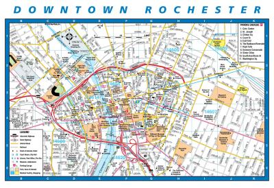
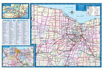
With one of the shortest commute times in the United States at an average of 20 minutes, Rochester is an easy destination to navigate. Getting to and from the airport - and all around town - is easy to do! Our downtown area is filled with city streets and buildings and charming towns and villages make up Monroe County. Rochester is within a 90-minute drive to Niagara Falls to the west. The picturesque Finger Lakes and wine region is to the east. And, the famed “Grand Canyon of the East,” Letchworth State Park is to the south.
Browse the following maps to discover the best way to get around as you explore Rochester.